Eastlake Shoreline Walking Guide
A walking tour of public shoreline sites in Eastlake
Note: Printable version of the Eastlake Shoreline Walking Guide (pdf).
With the pandemic and having to stay close to home, our parks and green spaces have never been more important.
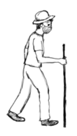
Take a walking tour and get to know our public spaces better. Each is unique, with its own story to tell. This tour moves along the Eastlake shoreline from north to south.
First a quick overview: The eight blocks of Fairview Avenue East between Newton Street (Terry Pettus Park) and the Ship Canal (where I-5 crosses the water) have been classified as a Neighborhood Green Street for more than 20 years, a designation intended to protect and give priority to pedestrians and bicycles as they mix with motor vehicles on the roadway. Part of Fairview along this stretch also extends out underwater between East Roanoke and past East Edgar Street. You’ll be able to spot that submerged right of way on the tour.
It is a wonder that Fairview has so far survived as a kind of country road. In the 19th century, railroads almost put a freight line here, and in the 1920s, the City considered it for a six-lane highway like Aurora Avenue.
Fairview Avenue south, between Newton Street and the Fairview Bridge (under construction), has seen improvements in the recent past from an industrial car- centered area to a more pedestrian friendly environment. More about that later in the tour as well.
All the public access improvements along Fairview have occurred just in the last 50 years, so these sites are still relatively new. And the Eastlake Community Council has led or been a participant in making improvements happen. One of the founding purposes of the ECC is to “maximize public use and enjoyment of the inland waters and shorelines adjoining the Eastlake community.”
Some remaining public access sites are still in planning— or should be. Volunteers are welcome and needed to help maintain established sites or achieve public access at new ones.
Beginning at the University Bridge:
EASTLAKE AVENUE E. | Street-end under the University Bridge – still in planning
Under the south end of the University Bridge is the Eastlake Avenue East street-end. Access is via a narrow road to the east of the bridge, Portage Bay Place. ECC is trustee of a $20,000 fund for public access improvements here, and some years ago a public process produced a draft design to create a viewpoint and to improve the plantings. Volunteers are needed to finalize and implement it. In the meantime, houseboat residents have installed some native wetland vegetation for waterfowl and muskrats.
FUHRMAN AVENUE E. | South Passage Point Park

This park on the south shore of the Ship Canal directly under the freeway bridge includes land that was once several homes as well as a Fairview street-end. The land has been owned by the Washington State Department of Transportation since construction of I-5. This park was built in 1973 on a design by the late landscape architect Richard Haag, who also designed Gas Works Park. As Elizabeth Berg wrote in the Autumn 2017 Eastlake News, “You will be greeted by green rolling hills down to the water and many comfortable places to sit and watch the members and students at the Pocock Rowing Center launch their boats. [There is also] a terrific view of the University Bridge – and the movement of the bridge - which is fun for visitors and children alike. Plenty of shady green space to spread out and the occasional duck or two make for a nice spot.”
E. MARTIN ST. | Good Turn Park
This park is quite large, offering a natural shoreline experience. The park was begun in 1991 by abutting landowners Homer Bergren and Jim Nordstrom, naming it after the Boy Scouts official slogan to “Do a Good Turn Daily.” Although SDOT had authorized paving the other two-thirds of the site for parking, Bergren and Nordstrom embraced a fundraising campaign by the community, and repurposed the paving money toward green improvements. The park was completed in 1998 jointly by ECC and the Olmsted-Fairview Park Commission. The landscape architect was Tom Zachary, who donated the second phase design. There is a custom-designed cedar picnic table and an informal gravel play area. The serviceberry trees in the center were donated by Richard Haag, and the logs marking the entrance were donated by the Army Corps of Engineers. There is a large California redwood tree that a neighbor planted many years ago. The park’s history is engraved on a granite boulder near the shore.
E. ALLISON ST. | Allison Street-End Park
On a formerly paved and bleak site, this small park was built in 2018 by the Seattle Department of Transportation. Designed to be accessible for people with disabilities, it features greenery, direct access to the water, a picnic table, and colorful log stools by artist Sam Trout.
E. SHELBY ST. | Fairview Park and the Eastlake P-Patch

Before this area was a park, the Eastlake P-Patch and the adjacent shoreline and wooded hillside were threatened by a1990 development proposal to replace all the greenery between Eastlake Avenue and Fairview Avenue with a huge building containing offices, residences, a multiplex movie theater, and a parking garage with access at Shelby Street adjacent to Fairview Avenue E. ECC mobilized to save the area, working with the newly formed Olmsted- Fairview Park Commission, and with the renters who were then living on the property. Against all odds, five years of grassroots struggle secured City, County, and State funding and the cooperation of the landowners and developer, and the Seattle Department of Parks and Recreation purchased the property in 1995. With continued extensive community involvement, Fairview Park opened in 1998. The park provided for a larger P-Patch and protection of the wooded hillside. Fairview Park includes a zigzag staircase connecting Eastlake Avenue and Fairview Avenue; walkways; a lawn; a floating dock (Waterway 11); a narrowing of Fairview Avenue E. to calm traffic; and a landscaped path along the Fairview shoreline.
One of Seattle’s earliest community gardens, the Eastlake P-Patch started in 1981 with an Eastlake News notice inviting volunteers to join in reclaiming the overgrown Shelby Street right of way. Now a part of the Seattle Department of Parks and Recreation’s Fairview Park, the P-Patch is a beautiful, intensively farmed garden that is free and open for the public to wander through and enjoy. There are 47 plots, public art, and a honeybee hive. As one participant notes on the City web site: “Along with the steady stream of smiling, strolling visitors, rendered briefly carefree through the power of flowers, the gardeners produce a staggering amount of top quality hyper-local, organic produce for local food banks.” For a photo, historical background, rules, and how to sign up for a garden plot, see the City’s web page.
FAIRVIEW AVE. E. SHORELINE BETWEEN SHELBY AND HAMLIN STREETS
The Fairview Avenue East right-of-way between Shelby and Hamlin Streets extends into the water, and thus the entire lake bank is in City ownership. The Eastlake neighborhood is fortunate that to accompany its nearby townhouse/houseboat/office/ moorage development, the Wards Cove company built on the public right of way at its own expense a full block of landscaped shoreline pathway, completed in 2009.
E. HAMLIN ST. | Hamlin Street-End Park
A three-year effort by ECC and the Hamlin Shores Homeowners Association turned this formerly overgrown and garbage-strewn street-end into a lovely and much-used park with views, picnic tables, trees, shrubs, and flowers, paths, and steps down to a bench and shallow beach. Opened in 1992, the park has been maintained and further improved by volunteers, especially the Hamlin Shores Homeowners. SDOT added a curb and sidewalk along the Fairview roadway in 2012.
FAIRVIEW AVE E. STREET-END BETWEEN HAMLIN AND EDGAR STREETS | Our smallest park and a connection challenge
South of Hamlin Street and where Fairview enters the water, residents maintain a tiny landscaped park. Standing here and looking southeast, the Edgar street-end is tantalizingly close--and the gap to be closed is less than meets the eye when one realizes that parts of both public rights-of-way are occupied by a private marina and parking lot that block what was once an historic walking and bicycling route. Until this link is restored, we must backtrack north on Fairview, climb up the steep Hamlin Street, then walk up, down and up again on the one-block roller coaster of Yale Terrace East, a named alley, to reach Edgar Street. For a detailed history of this connection challenge, see the ECC website, eastlakeseattle.org Shoreline Gap under Parks/Lake Union. For what might be done about it, see our next stop.
E. EDGAR ST. | A Future Possibility
In July the Seattle Times sketch artist, Gabriel Campanario, featured the E. Edgar Street end in one of his weekly Sunday sketches for the Times Pacific Northwest Magazine. His title summed up this street end’s dilemma: “There’s no sitting on the shoreline at this designated public right of way in Eastlake – just signs and brambles.”
He noted the dubious sign saying it’s a “Wildlife Sanctuary.”
“It might not be feasible to extend Edgar Street all the way to the shoreline,” writes Campanario, “due to the elevation drop between the roadway and the lake. But I could picture a restful lookout with a couple of benches in place of the brambles and those unofficial-looking signs.”

Actually, with consultation and design, a shoreline path that would also protect habitat is possible (see the ECC website, eastlakeseattle.org Shoreline Gap under Parks/ Lake Union). But at the moment Edgar Street end is not on the City’s radar for improvement. Omar Akkari, City
of Seattle Shoreline Street Ends Program Coordinator, suggests anyone interested in improving it should work through Friends of Street Ends, a volunteer-run group dedicated to assuring public access to the city’s waterfronts. Karen Daubert, a lead of FOSE, says she would be glad to help a neighborhood group interested in creating a street- end park and shoreline pathway connection at Edgar. She suggests contacting her through the web site https://www. streetends.org/ if you’re interested (let the ECC know as well).
E. ROANOKE ST. | Roanoke Street Mini Park(s)
This park has two sections – a south section which is in the Roanoke street-end and a little-known, hidden north section which is in the Fairview Avenue E. street-end.
First built by volunteers in 1971, the two sections were remodeled in 1976 by the Seattle Department of Parks and Recreation. In 2012 the south section was again improved, this time assisted by the volunteer Roanoke Street-End Improvement Committee with design and survey services donated by several firms and individuals.
The south section of the park has two plaques, one of which recognizes the City’s 2010 designation of a Lombardy poplar as a heritage tree, and it and three weeping willows as a heritage grove. The other plaque, installed in 2016 by the Boeing company as part of its centennial, commemorates the site’s former use as a hangar where its first plane was assembled and painted, and as the base for the first test flight, which William Boeing himself piloted in 1916 (after which he announced: “Gentlemen, we are in the airplane business”). The first U.S. international airmail flight also originated here in 1919.
The north section of the park, which is down a slope, has an excellent view of the block-long submerged segment
of Fairview Avenue; look down and to the left to view bass spawning beds. Unfortunately, this north section has deteriorated and was never accessible for people with disabilities. Volunteers are needed to coordinate with the City and community for design and funding of a much- needed renovation.
In between the two sections of the park is the entrance to the Roanoke Reef houseboats and boat moorage. Their docks use the pilings originally installed for a much larger proposal, a nearly block-long 60-foot-high over-water condominium complex. A court challenge by ECC and the Floating Homes Association, known as the “Battle of Roanoke Reef,” stopped the project.
E. LOUISA ST. | Louisa Street-End Park (aka “The Bouledrome”)
Built in 2006 as an ECC project with donations and hundreds of hours of volunteer labor, and $15,000 from Seattle’s Neighborhood Matching Fund. Prior to that the site had been vacated by a boat repair business, and there were proposals to pave it for parking. The most prominent feature of this park is its “bouledrome” for playing the French ball game, petanque. The bouledrome’s walls are City-donated granite curbs more than a century old, and the playing surface is (or at least, was) “Turface” brand pitching mound clay donated by the Seattle Mariners. A modular bench (donated in memory of Evelyn Sebaste, a local French woman and houseboater) can be used to watch the game or be reversed for the shore view.
E. LYNN ST. | Lynn Street Mini Park
One of Seattle’s first, this street-end park was built in 1971 by local volunteers led (and fed) by Pete Omalanz, founder of
the market across the street. The original design, featuring a shallow beach, was by the late Dick Wagner, founder of the Center for Wooden Boats.
The park soon became the responsibility of the Seattle Department of Parks and Recreation, which rebuilt it in 1976. But in 1995 an unattended beer truck rolled three blocks down Lynn Street, ditching in the lake and damaging the park in the process. The Parks Department extensively remodeled the park in 2002.
The walls, benches, and sign feature art tiles created by members of the community and public-works artist Maggie Smith. (An unsuccessful City effort to censor a tileportraying the beer truck created a small media sensation.) A Gaudi-style stone bench memorializes residents Peg and Tom Stockley, who perished in the 2000 Alaska Air crash. Just to the north is a City-required public access walkway and dock on the southern edge of the overwater Union Harbor condominium building.
E. BOSTON ST. | Public access opportunity
Fairview Avenue E. is unusually narrow at this undeveloped street end, unsafe for pedestrians and for enjoying views of the lake. As its steepness would not easily accommodate a park, the 1998 Eastlake Neighborhood Plan proposes a cantilevered pedestrian walkway to allow safe passage and views while preserving the street-end’s greenery.
E. NEWTON ST. | Terry Pettus Park (remodeling is now in planning)
This was also among the first parks in Seattle to be created out of a street-end. It was built in 1970-71 by volunteers including Terry Pettus, the late labor journalist and longtime secretary of the Floating Homes Association. (After Pettus’ death in 1984, his name was given to the park.. In 1976, the park was remodeled by the Parks and Recreation Department. The park includes picnic tables, a beach and a floating dock. One of the cherry trees was planted in memory of Doris Shanley, a founder of ECC. The park will be remodeled and expanded in 2021; see further details in an article on page 14.
FAIRVIEW AVE. E. SOUTH OF E. NEWTON STREET | Improvements through cooperation
Thirty years ago, the area south of Terry Pettus Park and to the Fairview Bridge was uninviting and dangerous
for pedestrians and bicyclists. Years of good will and constructive compromise brought a common front among residents and businesses that convinced City officials to make many needed improvements.
In 1994 the ECC-led Eastlake Transportation Plan designed a pathway, landscaping, and optimized parking for the two blocks between Newton and Blaine Streets, and in 1996 Seattle Public Utilities built these features that you’re walking on and through now as mitigation for a disruptive combined sewer expansion project. The adjacent U.S. Seafoods site (formerly occupied by the NOAA Pacific Marine Center) is on fill where there once was the lake and a colony of houseboats. East Howe Street also falls between these two streets.
E. HOWE ST. | East Howe Steps Plaza (in process)

The Howe Street right-of-way does not reach the lake, but it does connect Eastlake Avenue to Fairview. A coalition of community volunteers successfully campaigned for a public stairway, recently constructed, that further lengthens the Howe Street steps (already the City’s longest) down from Capitol Hill.
The volunteers have also worked for and secured City Neighborhood Matching Funds that in 2021 will help build a public plaza where the new stairway ends at Fairview and where a parking lot now exists.
FAIRVIEW AVE. E. SOUTH OF E. BLAINE STREET | A diamond in the rough

In the two blocks of Fairview between E. Blaine Street and the Fairview Bridge (currently being rebuilt), the western boundary of the right-of-way is entirely in the lake. LakeUnion Drydock (founded in 1919) does not own the lake bank; it owns submerged lands, and its docks, shops, and headquarters are over water.
For much of the 20th Century, this shoreline was blocked from public enjoyment by a wall of weeds and parked cars. The 1999 Eastlake Neighborhood Plan took up the neighborhood’s 1994 Transportation Plan’s call for a pathway between E. Blaine St. and the bridge, and with $20,000 from the City, ECC hired a contractor to scrape off the weeds, build the pathway, and protect it from cars with concrete stops. In the ensuing years, hundreds of volunteers replaced blackberries, ivy, clematis, and scotch broom with native plants, and ECC hired a barge crane to lift vintage Douglas fir logs donated by the adjacent Peterson Yacht Services and place them between the pathway and lake bank. A decade later the ECC successfully nominated the area for $750,000 in Neighborhood Street Funds, with which SDOT in 2013 widened and paved the path, protected it from cars with wooden bollards, installed retro streetlamps, planted native trees, shrubs, and ground cover, and reconfigured the Fairview Ave. E./Fairview Ave. N. intersection to make it safer for vehicles, bicycles and pedestrians. The area is still a diamond in the rough. Volunteers from among businesses and residents are always needed to help maintain it.
FAIRVIEW BRIDGE | Floating Walkway
When the current Fairview Avenue North bridge reconstruction is completed in 2021, SDOT will bring back the popular floating walkway that formerly paralleled the bridge. It will again provide water-level walking (and fishing) and an open water view.

For more information about any of the above sites, or to volunteer to help maintain or improve them, please contact ECC at info@eastlakeseattle.org, or c/o Lake Union Mail, 117 E. Louisa St. #1, Seattle, WA 98102-3278.
Judy Smith and Chris Leman contributed to the creation and writing of this tour. Sketches by Karen Berry.